- Home
- About Nick
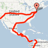
- Maps
- People helping the expedition
- Expenses breakdown
- Truck and equipment (Sept. 16)


THE ROUTE
-
Turning East toward Dar Es Salaam

Following a track leading to a Tanzania camp at dusk.
Every day in Malawi, I drive few hundred kilometers north and follow the lake. The progress is slow, due to the frequent police checkpoints and a multitude of villages where it is more prudent to slow down to 25 mph (40 km/h). Roads are not wide, and marketplaces bring many people on the tar.

Police checkpoint.
The police usually demand few documents, which I all have thanks to the dead time I had in Durban and some work in Photoshop. They sometimes make an attempt to say I was speeding, but usually don’t insist when I deny it.
In the afternoons, I stop in camp grounds easy to find on the shore of the Lake. It costs around US$ 4 a night, which is a good value compared to the cost in South Africa and Mozambique. There I spend time planning the following days, and list accommodations on the map.
Planning the following day.
I spend nights in Kande Beach and Chiweta. Some camps are pretty basic, while other offer electricity and hot water. Internet is not available, unless you are willing to spend a lot of money to get satellite access. I cook every night using the food I got in Blantyre. It is difficult to get more than very basic items in the few shops along the road. Cooking for myself ensure that I get a balanced and healthy diet. I boil the water I use to cook, and put bleach in my non-drinking water to wash vegetables or brush my teeth.

Grilled meat on the border of the road.
The roads are in good conditions and it is a nice change from Mozambique. Gas is expensive though and I will have to wait for the Middle East to get more reasonable prices. It is now my biggest daily expense. Unfortunately, I have rare exchanges with people. It is very difficult to have a normal conversation, as locals usually want to sell you something, and the cultural divide is huge. I believe many months in Africa would be necessary to be able to gain from exchanges with people. Don’t take me wrong, everybody is nice, and curious about the place I come, why I am doing this trip and they all want to know the price of diverse items in the U.S. They also always want to exchange mail addresses. Maybe I will one day receive some news…

Most roads are good, but there are still some rudimentary bridges.
As I advance north, there is a more mountainous landscape, and some forests. I recognize rubber trees which inhabitants milk after cutting the skin of their trunks.

Natural rubber is collected in the mountain.
The landscape is indeed more interesting up there, and I get better nights of sleep as the temperature is lower during the night. As I know I will spend some time in higher altitudes, I take some time to change my rear brake pads, which I bought back in Texas. I doubt I would have been able to find parts in this part of Africa, as I don’t see many Land Cruisers on the roads. As in South Africa, there are many used vehicles coming from Japan, and also the group Tata seems pretty successful with their trucks.

The shore of Lake Malawi.
Very few individual vehicles are in fact seen on the road, mostly buses and trucks. People here use bicycles as the main transportation mode, very often just pushing a bike loaded with goods.

The landscape becomes mountainous.

Basic accommodations…
The last campground I stay at has no showers, no electricity and fence, which makes me wonder why I just don’t sleep on the border of the road (Where it is located as well…). It is time for me to go to the next country. Tanzania.

The welcoming border between Tanzania and Malawi.
When I get to the border, it is a little bit trickier than previous crossings. In fact, it’s just a question of money. The Tanzanian authorities want some cash. At first, they ask me US$50 for a visa. I find it too expensive, and I wonder if it is a scam. I can’t remember how much it is supposed to cost. So I tell them it is too expensive, and have to sit down with the chief who finally agree to bring down the cost to US$30. Later, when I look into my notes, I figure the visa is indeed supposed to cost $50. In addition, they want me to pay US$25 for road tax. I don’t have enough US dollars easily accessible, so they agree to let me pay US$5 for a week worth of the tax. I can later go in a city to pay more to extend. Or not.

A common sight at border crossings. Street vendors offer food to travelers.
Once again, I have no currencies for this new country, and almost no gas left. In the first town I stop, I can’t get cash at the ATM. I have to try to get to Mbeya with the fuel I have left. And I reach the city, probably running on gas vapors. There I am able to get cash, fill up the tank and an additional jerry can I usually keep with me full at all time. It cost me almost 200,000 Tanzanian Shillings. Sounds expensive…

Open or closed? Open.
Later on, I get to a church-run center where they let me camp for a dime. The following day, I will take the direction of Dar Es Salaam on the long northeastern road through the low mountains.

Going to Dar Es Salaam.
I leave in the morning and begin my trip through the wonderful landscape. I changed time already, and I am now at GMT +3. I have tons of things to do in the large city, mostly visas, and I hope everything will go well. As I am driving, I try to remember everything I need to get done. This does include stopping at the French embassy for my passport problem, get the Ethiopian visa, which I can’t get at the border as I usually do, and also spend some time on internet, so I could reply emails and update my blog.

Going northeast.
The trip to the city should take me two days at least. The road is sinuous, and there are an impressive number of accidents. I pay extra attention and prefer to go slow than to finish down the mountain.

Common sight in the mountain.
At the end of the day, I stop close to Mikumi, in a campsite surrounded by baobabs. I am the only visitor there, and decide to use the restaurant of the camp. After all, I don’t have anymore food left, and definitely deserve a nice meal. In the morning, I decide to stay an extra day to wash some clothe and prepare my visit to Dar Es Salaam.

Two days to go to Dar Es Salaam.
-
Who needs a road?

Eventually seeing real Africa, as I am going through villages on dirt tracks.
Shortly after I wrote my last post, and before I left Gorongosa, I had dinner with South African travelers. In a magazine, they showed me an article relating the attempt of an expedition to trace back the last trip of Mary Livingston. Two days later, they would try to follow this route as well, leading into Malawi. This was only possible using a barge to cross the Shire River, since the bridge in Vila de Sena was not operational anymore. On the spot, I decided to change my route and make a run for Malawi. I was ready for a change in landscape, tired of the flat country of Mozambique. The following morning, I exited the park, and went east.

Beginning a long trip on dirt roads
Few hours later, I crossed the Zambeze River, and after few miles, left the main road and began to work my way on a dirt track. I didn’t suspect I would follow such track for the next 24 hours. The day was cloudy and dark, and rain was falling since noon. It took me three hours to do the 140-miles (224 km) to reach the vicinity of Mutarara.

Getting some company as I leave the main road to work my way to the border
There, around 4:30 p.m., I learned that due to heavy rains, there was no boat crossing the Shire. I had no choice but to backtrack. And quickly, as night would come fast. Indeed, it was pitch black when I got to Morrumbala, a town I crossed 60 miles back on the dirt road. I was shared between staying there for the night or going back to the main road, and probably driving all night long since there was no accommodation around. Staying would have been great, but where? As I was roaming the street of town, I spotted a building with the European Union flag. It was the office of an electric company for the region, getting grants from Europe. Under the rain, they opened the gate, and allowed me to stay for the night. I was done with another long day of driving during which I have been afraid every minute to discover the road under water.

Resuming the trip in the morning
With the staff of the NGO, we looked at military maps they owned, and one of them explained to me which route I should follow to reach the border with Malawi. I was to reach Derre, then Macatanja, Liciro and finally Milange, the border town. It would take me 6-hours if the road was not muddy or submerged. I decided to give it a try the following day. Luckily, there was fuel in Morrumbala, and I could get enough to go and backtrack if something went wrong.

As long as the river is under the bridge, I am good to go.
I left very early in the morning, got a full tank of gas, and went east. The road is all right, despite the fact that it rained all night. After few hours of driving, I took a larger dirt road north, and as expected, 6-hours after departure I arrived in Milange.

The dirt road gets wider as I approach the border with Malawi.
The border crossing is easy and doesn’t cost me anything. I now have only one blank page in my passport, enough to get the Tanzanian visa, get to Dar Es Salaam and obtain an emergency passport. As soon as I am on the Malawi side, I am welcomed by tar roads.

I am glad to be back on paved roads
Along the way, I see a lot of people working in the fields, picking leaves. At first I am not sure what it is, but soon enough, I realize this is tea.

Tea country
I get to Blantyre where I go in a supermarket, the first I see since South Africa. I get plenty of groceries, and leave the city immediately after, just taking the time to get some cash at an ATM. I am not sure what the exchange rate is, but I take 20,000 at the machine, the maximum suggested amount. I go north, and when I reach Zomba, it is dark. It is also cold, and I am now surrounded by forest at 1,400 meters high. I set up the tent, fix dinner, and go to sleep.

Trout farm campsite
The campsite I found is located in a trout farm (R600, still not sure what it is in US$). In the morning, I take a walk in the forest and take a hot shower. This is strange as in South and Central America it is difficult to find hot showers even in hostels, but here in Africa, you find it in the most unexpected places. Usually, thereís a permanent fire under a water tank which provide the needed water through the day.

Deep forest on the Zomba Plateau
At 10 a.m. I am gone, and driving toward the Lake Nyassa, also called Lake Malawi. The lake stretch 500-km down the eastern border of the country.

Crossing the forest and reaching lower altitudes
I reach the lake at Senga Bay, east of Salima, after another day of driving and a delay caused by an error in a map. There are no signs to be found, so you are never entirely sure of which road you are taking.

A beautiful mountainous landscape characterize Malawi
Inhabitants smile all the time and are helpful, but a bit pushier than in Mozambique. They speak English which is easier for me to deal with than Portuguese. Tourism seems more developed here.

Village in the mountain as I get closer to the Lake Nyassa
In Senga Bay, I find a camping on the border of the lake, and relax on the small sandy beach. In the next days, I will be following the water until I reach the Tanzanian border.

Lake Nyassa, also known as Lake Malawi


