RSS feed

LIKE THIS WEBSITE?

So send me few $$ I will use toward the hosting of the blog. Thanks! Via Paypal.
GET UPDATES ON

ABOUT THIS BLOG

In the summer of 2009, Nicolas Rapp decided to take a break from his Art Director job at The Associated Press to attempt a one-year overland travel around the world in a 1996 Toyota Land Cruiser. He was back in New York in February 2011 after traveling 15 months and 37,000 miles.

Visited countries

Calendar

April 2024
M T W T F S S
1234567
891011121314
15161718192021
22232425262728
2930  

MONTHLY ARCHIVES

THE ROUTE

Click to see the map


  • Nevada and Arizona, states of great contrasts

    Posted on February 6th, 2011 Nicolas No comments
    Playing craps at the Venetian.

    Craps table at the Venetian.

    I arrive in Las Vegas on Friday afternoon and check-in what may be the cheapest hotel on the Strip, the Imperial Palace. Nauvlet – a follower of the blog – works for the group who owns the casino, and she was able to get me a great price. After a hunt to find free internet in the city – which is almost mission impossible – I find myself working at the public library and updating the website.

    Welcome to Las Vegas.

    Welcome to Las Vegas.

    Last time I was in Vegas was in 1998, and I feel that the place changed a lot. But this has always be the story of this city located in the middle of the desert and surrounded by mountains. Back in 1911, there was not much there to be found, until divorce laws got liberalized in the state of Nevada.

    The Luxor casino. 4,400 rooms in the pyramid.

    The Luxor casino. 4,400 rooms in the pyramid.

    A quickie divorce could now be attained after six weeks of residency which was much easier than in other states. Short-term residents needed places to stay, and hotels on the Strip were born. Nowadays, the city is in bad shape due to the collapse of the real estate market, and the unemployment rate is above 14%.

    The New York, New York casino. Am I home already?

    The New York, New York casino. Am I home already?

    Meeting with friends.

    Meeting with friends.

    There, I meet with some people following the blog, and we go out for dinner. I also see again Gwenaelle and Max, who flew from Texas to meet me. They are longtime French friends who live in Houston, Texas. You may remember that I stopped there for a quick visit in November 2009 on my way out of the U.S.
    Back then I had no ideas of all the adventures awaiting me.

    The Venetian casino and hotel, built at a cost of $1.5 billion.

    The Venetian casino and hotel, built at a cost of $1.5 billion.

    Trying my luck – with no success.

    Trying my luck – with no success.

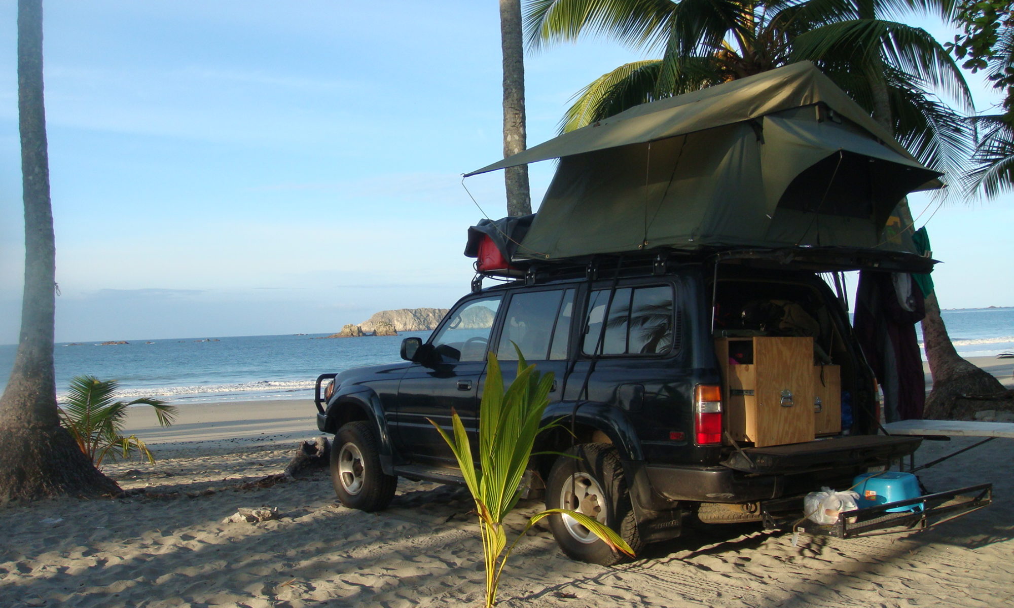
    Since then, I drove 35,000 miles in my effort to go around the world. We spend two days in Las Vegas visiting the casinos and observing the interesting architecture and interior decoration of these astonishing places. The major attractions in Las Vegas are the casinos, hotels and more recently fine dining. The most famous hotel and casinos are located on Las Vegas Boulevard on the portion called the Strip. Many of these hotels are huge and have thousands of rooms as well as vast casino areas.

    View of the Strip.

    View of the Strip.

    The Hoover Dam, harvesting the power of the Colorado River.

    The Hoover Dam, harvesting the power of the Colorado River.

    One historical event which was part of the city growth was the construction of Hoover Dam in 1931. This did bring an influx of construction workers and started a population boom giving the city in the grips of the Great Depression a most needed boost. The dam was the next place we were going to visit. Back in 1998, I drove from Las Vegas to the Grand Canyon, and at the time I had to use the road on the dam to cross the Colorado River.
    Since October 2010, a new bridge has been open, which allows vehicles to by-pass the dam. Regardless, I took the alternative route so I could stop quickly once again at this monumental piece of engineering.

    The new bridge across the Colorado River.

    The new bridge across the Colorado River.

    Once the bridge behind, we were driving through Arizona. We pushed to Williams – 60 miles south of Grand Canyon Village – and stopped for the night. That was the first night of serious cold, and not the last.

    View from the Grand Canyon south rim.

    View from the Grand Canyon south rim.

    The Grand Canyon, 277 miles long and 6,000 feet deep was carved by the Colorado through the rock layers of the Colorado Plateau. It is truly is a special place, and one that you can never forget after visiting.

    Spectacular view once the fog is gone.

    Spectacular view once the fog is gone.

    Buttes, spires, mesas and temples in the canyon are in fact mountains looked down upon from the rims.

    Buttes, spires, mesas and temples in the canyon are in fact mountains looked down upon from the rims.

    During the winter, the north rim of the Canyon is closed to traffic due to heavy snow, but the south rim remains open. The trouble met by a traveler during this season is the visibility. The winter fog can be present and you may not be able to see anything when visiting. It is what I got in the first few hours of the day, and I was beginning to think I would not see the Canyon this year. But suddenly, shortly after noon, the white veil lifted, and the fantastic view appeared. Of course the haze dimmed the vivid colors, but regardless, the show was spectacular. In the winter, all the roads of the south rim are open to vehicles, which make the exploration easier as well.

    Still looking good for a 2 billion years old canyon.

    Still looking good for a 2 billion years old canyon.

    Going down the road and exiting the park via the eastern route is amazing as well, and one can find surprising natural wonders on the route to Tuba City as well. It is where we stopped for the night. There was not much to do in this small town on the western side of the Navajo Nation. Chief Tuba – at the origin of the place’s name – converted to Mormonism in the late 1800s and invited the Mormons to settle in the area. Tuba City was founded in 1872 and is now home to 8,000 inhabitants, most of them Navajo.

    Leaving the Grand Canyon.

    Leaving the Grand Canyon.

    The next destination was Monument Valley. As we progressed east in the morning, the weather got worst and snow began to fall in a dense fashion. Visibility dropped quickly, and it was rapidly more difficult to drive on the icy roads.

    As we get closer to Utah, snowfalls get worst.

    As we get closer to Utah, snowfalls get worst.

    The road 163 is recommended for the fantastic scenery surrounding it, but there’s not much we could see while we drove it. After a while, we arrive at Monument Valley park headquarters, and given the weather, the staff there didn’t recommend a visit of the site. Maybe I’ll see it next time I go around the world…

    The scenic route 163. Exciting even in the snow.

    The scenic route 163. Exciting even in the snow.

    We enter Utah and the snow suddenly disappears. But it gets much colder as well. We arrive in Blanding, southeast of the state earlier than scheduled, and it is for the best as I have to get some things done before sunset. The temperature is supposed to drop to -10 Fahrenheit (-23 Celsius) later, and I am afraid for the radiator of the Landcruiser. Last time I changed the cooling liquid was in Bangladesh, and it was then hard to imagine such cold temperatures. In order to save money, I used a ratio antifreeze/water pretty low, and now I have to deal with the consequences.

    The snow disappears as we enter Utah.

    The snow disappears as we enter Utah.

    In the freezing cold, I am able to empty a third of the radiator and refill with unmixed antifreeze. That is probably what allows me to start and drive without trouble the following day. The weather is not going to get any better as I progress east, and I am now getting closer to the Atlantic winter storms. I plan to arrive in New York on February 12, and it is an thrilling prospect. This Sunday, folks in the city can read in the New York Times an account of my trip through Cambodia with my friend Vikas. It feels like an early welcome back from the city I am from.

    The colder temperature I have been in so far.

    The colder temperature I have been in so far.

  • Back in the desert

    Posted on January 31st, 2011 Nicolas No comments
    Salt pan in the Death valley seen from Dante's Peak.

    Salt pan in the Death valley seen from Dante's Peak.

    It has been a long time since I have been in the desert. I want to say I missed it, but when I recall my adventures in Ethiopia, I can’t say it was party time either. But as time went by, I now see this period with nostalgia. This week I was in Death Valley, and no landscape I saw so far reminded me as much as the desert in eastern Ethiopia.
    You can check this old post if you don’t recall my misadventures as I was trying to get through the Djibouti border.

    Mission in San Luis Obispo.

    Mission in San Luis Obispo.

    But let’s begin by the beginning. This week started with my departure from Los Angeles and a first night in San Luis Obispo. A new routine began, and I am cooking every night, trying to save cash while the temperatures are still comfortable. Of course I am not speaking about cooking amid wonderful landscape in remote areas, but more in the parking of cheap motels. Still, I am glad to use my camping equipment again.

    Oil field before Porterville, Ca.

    Oil field before Porterville, Ca.

    After a quick visit through the town, I continued my drive northeast toward Porterville, the last city before attacking the mountains. Between the cities, it is a strange area. Not much to see but endless agricultural fields, oil fields, and a dense fog as I approached the mountains’ feet.

    Numerous orange trees and vines can be found close to Porterville.

    Numerous orange trees and vines can be found close to Porterville.

    The traveler can still be rewarded by trying one of the tacos truck along the route serving generations of Mexicans who came here to help with the hard farm labor.

    In the mountain, the southern part of the Sequoia National Park.

    In the mountain, the southern part of the Sequoia National Park.

    I can’t say that Porterville was the highlight of my Californian adventures, and I failed to identify a true center in the city during a hike in the empty streets.

    Lunch break at Isabella Lake.

    Lunch break at Isabella Lake.

    Entering Death Valley.

    Entering Death Valley.

    The following day, I was thrilled to go up in the mountain toward the Sequoia National Park. Unfortunately, after 30 miles up, the road was cut by snow. In the winter, snow is not cleared on this portion of the 190 going to Camp Nelson. My father and I went back down the road and tried with success a more southern route to get to Isabella Lake.
    After a break there for lunch, we drove due east and spent the night in the high-desert city of Ridgecrest. All the poetry there can be found in the desert and the four mountain ranges surrounding the city.
    But the best was to come. The following day, we started our trip through Death Valley, and I found myself unexpectedly back in time and living again my trip through Ethiopia.
    When you drive cross country, it is worth getting the National Park pass “America the beautiful”. For $80, you and your party can go for free to any national park for one year. In my case, the pass will have probably paid for itself before the end of my road trip.

    Death Valley.

    Death Valley.

    According to the National Park Services, Death Valley was given its name by a group of pioneers lost here in the winter of 1840s. Only one of the group died here, but they all assumed that the valley would be their grave. As they climbed out of the valley over the Panamint Mountains, one of the men looked back, and said “goodbye, Death Valley.”

    The Red Cathedral.

    The Red Cathedral.

    We took a popular route through the Valley. We stopped first at the sand dunes and then went south along the Badwater road, to get to the Badwater Basin. At 282 feet below sea level it is the lowest point in North America.

    Views from

    Views from Zabriskie Point.

    On our way back we took the Artist’s Drive and stopped at Zabriskie Point and Dante’s View, two locations providing breathtaking views on the park’s mountains.
    At the end of the day, after sunset, we arrived at the Amargosa Hotel, a Spanish colonial style edifice built by a mining company in the 1920s. It is listed as the top-ten haunted hotel in the country, but tired, we didn’t witness anything worth more attention than our beds.

    The Amargosa Hotel.

    The Amargosa Hotel.

    After driving few hours in the morning and crossing the state line, we arrived in Las Vegas, Nevada.