The hard way north through Mozambique

Sunrise at Inhassoro

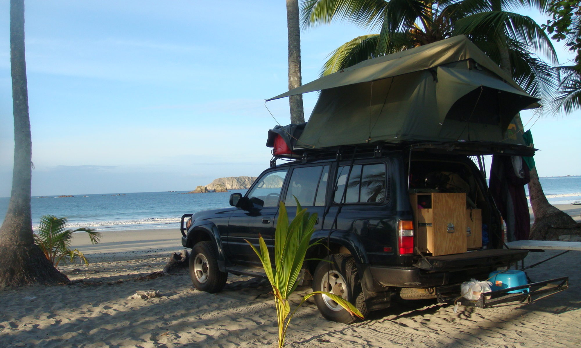
Not much to report about these long days going up Mozambique. The 1,600 miles (2,500 km) coastline takes a lot of time and endurance to go through. Basically, I have been following the coast along the main road, and every night, I get to the beach where there are campgrounds.

Passing the Tropic of Capricorn line.

The landscape sometimes reminds me of Nicaragua, with its always present palm trees. The roads are getting harder the deeper in the country I enter. After stopping in Xai-Xai, I spend one night in Zavora, then two nights in Tofo. 280-miles later (450 km), I am in Inhassoro, after a difficult day.

Roads are so bad people rather drive on the side of it.

After a 100-km stretch of very bad road with huge potholes and seeing a lot of people on the side with diverse problems, I myself stop to check if the truck is still in one piece. Sure enough, I have a puncture on the front right tire.

Fixing a tire.
Fixing a tire.

That would not be a big deal usually, and after plugging the hole, I am getting ready to continue my drive. But the badly shook car now has another problem. For some reason, the alarm system got damaged. With the siren blasting and the truck refusing to start, I have no choice but unplug the battery and un-mount the dashboard to hot-wire the truck. It takes me an hour and an half to find a fix to the problem, after which I am on my way.

Every night, I reach the beach via dirt roads to camp.
Every night, I reach the beach via dirt roads to find a campsite.

I make it to Inhassoro around 5 p.m. and un-mount again the dashboard to fix properly the system, which takes me two more hours. Exhausted, and after a shower I am lucky enough to find a very nice restaurant in the dilapidated resort where I camp

The tourism infrastructure has hard time getting back to normal after what the country went through.

There, I am happy to have grilled fish and well-deserved Heinekens, listening to the sound of the waves crashing on the beach. It definitely gives you a good feeling when the day was full of problem and you were able to overcome them and put some miles behind.

Sunrise on the Indian Ocean.

I wake up early the following day, knowing I have again a very long stretch to come. I get a full tank of gas in the beach town as by now it became extremely difficult to know what will be the next fuel stops.

Not much details on the type of fuel you fill up with.

There are no other choices in stations than one type of petrol and diesel, and no one knows what the octane of the petrol. Station attendants operate pumps with generators, as electricity is not available, or can’t be depended on.

The landscape becomes greener, and palm trees less dense as I progress toward the north.

The same night, I reach the Gorongosa National Park. I was very curious about this stop. Before the war, it was known as one of the best parks in Africa. The wildlife was decimated in the fighting and it will take a while for the park to recover its former glory. I was looking forward to see a park that would be less touristy than Kruger, even if it meant fewer animals. Unfortunately, as I get there, I learn that there has been too much rain, and the government closed the roads of the park… Just my luck after such a long drive.

Rio Pungue
Rio Pungue

Rain already prevented me to visit the Machu Picchu, got in my way on the Bolivian salt pan, and now I can’t see my friends the monkeys because of it.
Regardless, I can use the campground there, so I am just happy to crash for the night. Today, I am still there, as I have to take care of such prosaic tasks as laundry. I am also recovering from a bad blister on the neck caused by the blazing sun, and some insect bites in a place that makes it hard for me to walk. The following days will be even harder, as I am just half done with the country, and still have the north part ahead of me, the harder one to cross. Up there, there will be long days of driving, and less accommodations and fuel stop to be found. I am afraid also of the internet availability, so don’t be worry if there are no postings for longer than usual. Wish me good luck.

14,000 miles from New York City to the first elephant

OK, I'll let you go...

Another early start the following day allows me to see more wildlife. The sun raise early at around 6 a.m., and soon enough, temperatures and humidity are at the highest. Most days, the temperature is more than 30 degrees C.

After riding dirt roads for the first two hours of the day, I am out of the Saint Lucia Wetlands Park, due west in order to avoid Swaziland. My passport is almost full, and until I get another one – probably in Tanzania – I need to avoid too much border crossings.

Alongside the Swaziland border, I find pine forests

As I go north following the Swazi border, I gain in elevation, and soon enough, I am deep into huge forests of pines. Eventually, I stop in Amsterdam for the night, where a white farmer let me camp on his land.

Towns up there are simple, but you can feel the timber trade put a little bit of extra money in pockets, compared to other places I crossed.

Gold Stock Exchange
Gold Stock Exchange
Globe Tavern
Globe Tavern
Lewis and Marks building

I leave in the morning, and use dirt roads through the forest to reach Barberton, a city of historical interest. Of commercial interest as well, for me, since I need to get a bit of groceries, to cover for my needs while I will be traveling for few days through Kruger National Park. When it is done, I visit the town, and discover the history of this old gold mine site. Some preserved Victorian homes as well as elegant buildings make the place an interesting stop. Sights include the De Kaap Stock Exchange building, built in 1887 site of the first gold exchange in South Africa. In the same street, the Globe Tavern and the Lewis and Marks building are from the same period.

10 minutes after entering Kruger, I see my first African giraffes.

I have lunch there, and get back in the truck to drive a bit more and reach the park gate at the end of the afternoon. At the Malelane gate, a hotel let me camp in the backyard for US$13.

At 5:30 a.m., monkeys can witness once again a French guy coming out of his tent, tired but excited about seeing more of Africa. Extended time in Buenos Aires, Johannesburg and Durban reinforce my pleasure of being out camping.

Lions sighting in Kruger around noon.
Hyena close to the campsite

For around US$ 40, I can enter the park, and pretty soon, I see many animals, including giraffes.

I spend the day driving north across the park, and find a small rustic camp where electric wires protect travelers from omnipresent hyenas. It cost me US$10 to stay here for the night and have a nice bush camping experience.

Sunset on the Oliphants River.

After a night in the camp called Balule, I get again an early start to see hippos, zebras, elephants and hundred of antelopes.

Antelopes
Antelopes

The most impressive of course are elephants. You can really see a lot of them here.

Elephants
Elephants

Around 11 a.m., I go east and after an hour, I reach the border with Mozambique. This is a straight forward affair, since there are not many people crossing at this location. The visa cost me US$25.

Zebras in Kruger
Zebras in Kruger

Once I pass the border, I find myself in the Limpopo Park, the equivalent of Kruger on the Mozambique side, and have to pay US$10 to cross it. It is done in two hours of dirt roads, which become a badly potholed tar road.

The road to the Mozambique border.

After hours of driving, and after dark, I am back on the Indian Ocean coast, looking for a camp ground. I find one on the beach in Xai-Xai, where I am happy to stop, exhausted by the long drive (US$ 8.50).

Crossing villages in Mozambique

Mozambique is still recovering from a traumatic past. Formerly a Portuguese colony, the country went through a war of independence, and a civil war ending in 1992. Natural disasters also took a toll on the inhabitants.

P_elephantInfrastructures are in bad shape, even so the country seems to be on the rise, and gets a bit more tourists every year. It should be an interesting trip of around 2,000 miles across the country. As previously thought, it looks like finding spots for camping will be harder in Africa compared to Latin America. I stick to camp grounds at this point, and will see how things change while I am going north.

Sunset in Kruger
Sunset in Kruger