
Shortly after I wrote my last post, and before I left Gorongosa, I had dinner with South African travelers. In a magazine, they showed me an article relating the attempt of an expedition to trace back the last trip of Mary Livingston. Two days later, they would try to follow this route as well, leading into Malawi. This was only possible using a barge to cross the Shire River, since the bridge in Vila de Sena was not operational anymore. On the spot, I decided to change my route and make a run for Malawi. I was ready for a change in landscape, tired of the flat country of Mozambique. The following morning, I exited the park, and went east.

Few hours later, I crossed the Zambeze River, and after few miles, left the main road and began to work my way on a dirt track. I didn’t suspect I would follow such track for the next 24 hours. The day was cloudy and dark, and rain was falling since noon. It took me three hours to do the 140-miles (224 km) to reach the vicinity of Mutarara.

There, around 4:30 p.m., I learned that due to heavy rains, there was no boat crossing the Shire. I had no choice but to backtrack. And quickly, as night would come fast. Indeed, it was pitch black when I got to Morrumbala, a town I crossed 60 miles back on the dirt road. I was shared between staying there for the night or going back to the main road, and probably driving all night long since there was no accommodation around. Staying would have been great, but where? As I was roaming the street of town, I spotted a building with the European Union flag. It was the office of an electric company for the region, getting grants from Europe. Under the rain, they opened the gate, and allowed me to stay for the night. I was done with another long day of driving during which I have been afraid every minute to discover the road under water.

With the staff of the NGO, we looked at military maps they owned, and one of them explained to me which route I should follow to reach the border with Malawi. I was to reach Derre, then Macatanja, Liciro and finally Milange, the border town. It would take me 6-hours if the road was not muddy or submerged. I decided to give it a try the following day. Luckily, there was fuel in Morrumbala, and I could get enough to go and backtrack if something went wrong.

I left very early in the morning, got a full tank of gas, and went east. The road is all right, despite the fact that it rained all night. After few hours of driving, I took a larger dirt road north, and as expected, 6-hours after departure I arrived in Milange.

The border crossing is easy and doesn’t cost me anything. I now have only one blank page in my passport, enough to get the Tanzanian visa, get to Dar Es Salaam and obtain an emergency passport. As soon as I am on the Malawi side, I am welcomed by tar roads.

Along the way, I see a lot of people working in the fields, picking leaves. At first I am not sure what it is, but soon enough, I realize this is tea.

I get to Blantyre where I go in a supermarket, the first I see since South Africa. I get plenty of groceries, and leave the city immediately after, just taking the time to get some cash at an ATM. I am not sure what the exchange rate is, but I take 20,000 at the machine, the maximum suggested amount. I go north, and when I reach Zomba, it is dark. It is also cold, and I am now surrounded by forest at 1,400 meters high. I set up the tent, fix dinner, and go to sleep.

The campsite I found is located in a trout farm (R600, still not sure what it is in US$). In the morning, I take a walk in the forest and take a hot shower. This is strange as in South and Central America it is difficult to find hot showers even in hostels, but here in Africa, you find it in the most unexpected places. Usually, thereís a permanent fire under a water tank which provide the needed water through the day.

At 10 a.m. I am gone, and driving toward the Lake Nyassa, also called Lake Malawi. The lake stretch 500-km down the eastern border of the country.

I reach the lake at Senga Bay, east of Salima, after another day of driving and a delay caused by an error in a map. There are no signs to be found, so you are never entirely sure of which road you are taking.

Inhabitants smile all the time and are helpful, but a bit pushier than in Mozambique. They speak English which is easier for me to deal with than Portuguese. Tourism seems more developed here.

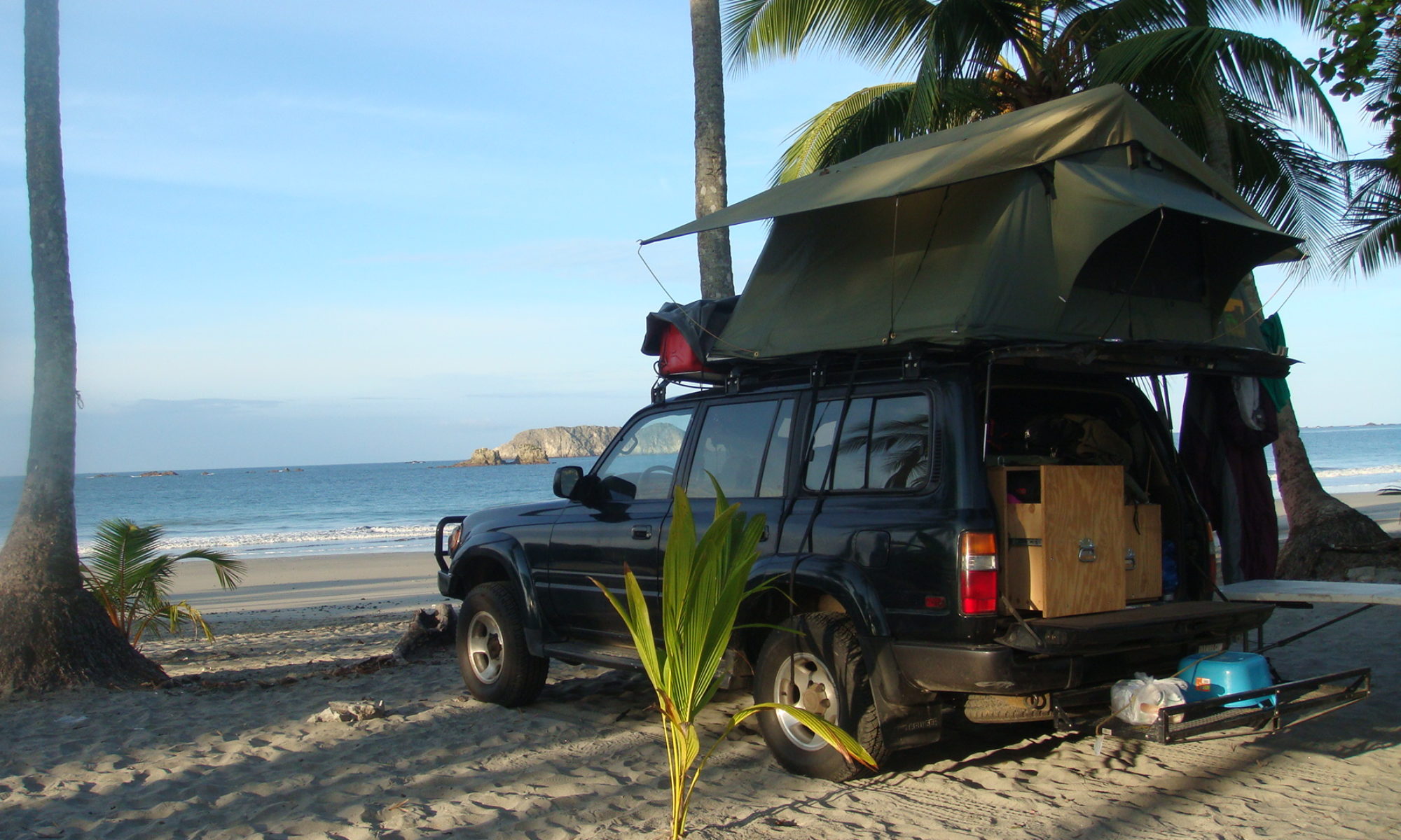
In Senga Bay, I find a camping on the border of the lake, and relax on the small sandy beach. In the next days, I will be following the water until I reach the Tanzanian border.

That lake is wonderful! It must be huge!
One USD is equal to 150 Malawian kwacha. So it was 4 USD to camp
Nick…you make this trip sound almost easy. Keep it up and I pray blessings on your travels
Currency is called Malawian kwacha (MWK). Exchange rate is $1 US to 150 (MWK).
So 600 (MWK) is $4 US.
Wow Nick! You took a chance and could really feel your excitment in your writing. I really believe the excitment and chances are very thilling for you. I know you had those exciting times when you were with Nadia, but now it must seem surreal doing the trip by yourself. You sure are showing us a different side of Africa. Glad to hear you can get groceries and a hot shower. Forge on my friend!
Ms. Marti-Nashville, TN
In regards to your passport. It used to be that all you had to do was get
extra pages to insert. I don’t know if that is still the case?
http://travel.state.gov/passport/forms/ds4085/ds4085_2662.html
Darn, looks like they have to add them. Maybe a U.S.
consulates office can do this in person? To bad it wasn’t done ahead of time.
Well, I am confident you will figure it out…………BEST of luck
on this intriguing journey you are on! Take the best of care.
I have followed you from the start, I feel like I am right along with you. Nick you keep safe and keep up the great blogs. Good luck to you. April
Good to see your post. The navigation part without signs is a hard thing, possibly similar to some of the undeveloped western US tracts on the BLM lands.
It is difficult, but not impossible, to follow your route on Google Earth.
Watch out in the Somalia region. You may want to hire local guides / security.
Beautiful photos. It looks like you’re having quite an adventure. Looking forward to the next installment.
Nick,
You’ve got us all on the edge of our collective seats!
Keep on truckin’
Cheers,
Harvey
I am totally jealous, but in a good way 🙂
Please take care!
-Faye
Toronto, ON
Amazing!! I hope to be able to make a trip like this myself someday.
Please keep the blog entries coming.
Stay safe and God bless.
I have been following you since central america and you are a brave man. I envy you your tip and wish you all the best. May your luck hold and I look forward to living vicariously through you.
Cheers
Steve
Good to hear from you. The pics are amazing! You DO make it look so easy. Just be careful out there!
Wow…what a trip. You seem to take all of these problems in stride. Me, dealing with washed out roads, poor maps, and ??? I couldn’t do it. Keep the faith and I trust that all goes well on your adventure.
Wow, what a ride we are taking. We are all traveling along with you through your words and pictures, you make it seem so simple. I know that keeping the truck up and running, making sure you have all your papers in order and items needed befoe they “are” needed is not a simple matter. You are doing a great job with your blog, thank you for thinking of us all waiting in our seats for the next posting, while you are bumping down those dirt roads.
Safe travels & safe roads!! Dan Lisa & Bryce Minnesota
Excellent!
Wow what an insperational trip. Talk about a story to tell the grand kids. Keep on truckin and best of luck in the miles ahead.
hey, me alegra que todo vaya bien,cuidate mucho desde honduras,abrazos y sigue adenlante.
I have followed you from the beginning. Your blogs are amazing and so interesting. The pictures are awesome! How lucky you are to be experiencing partd of the world that most of us will never see. Safe trip!
Don’t get an emergency passport, just ask the embassy of your passport to add pages. Easy enough and you don’t need to spend money. its FREE!!!!!!
Nick,
Haven’t check in for a while. Great stories, awesome pix! Do you listen to a music behind the wheel or would that be a disturbance?
Cheers!
-Mike (Prague, Czech Republic, Europe)
The picture of the village on the mountain top is absolutely amazing! I love it! You are doing great Nick! Thanks, for broadening our horizons.
Thanks Nick! You have made it very exciting to all your followers! All pix are excellent!
Lupster
Thanks for sharing pics of a kind of Africa we don’t normally see. They’re some of the most beautiful places I’ve seen yet!
Safe journeys and curious to know about the emergency passport deal.
yo cool how one person was able to put there picture with their comment (hav’nt figured that one out) you also get the exchange rate too here— so cool !!!!!!!
All very true, but I don’t support what you say myself. I will go along with the more traditional view. But I certainly support your right to say what you want. Cool anyway.