There are two ways to reach the south of Colombia from Cartagena. One can take the west road using the Pan-American Highway through Medellin and Cali, or the east road, through Bucaramanga and Tunja. We took the latest, in part because it is less touristy, and also because there were some people we wanted to touch base with in the capital.
After getting the containers guarantee back on Monday morning, we said good-bye to our French friends. They would use the other road, so we were splitting. We may meet them later, around Popayan.
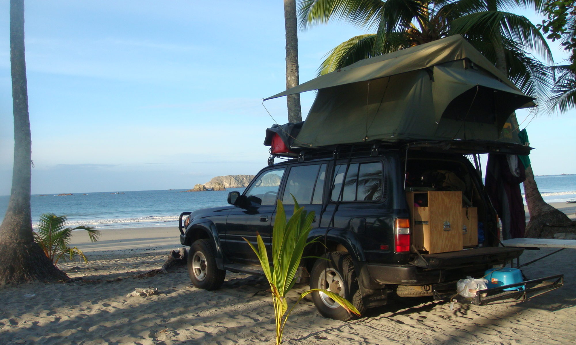
The first day of driving was one of the hottest we got so far. Hot and dry. I hear Colombia is in the middle of a drought, which doesn’t help. I drove 500 kilometers (310 miles), and we stopped to camp in a farm. At night, we played dominoes with the kids. Such hot climate is difficult, because in the morning and evening, you REALLY want to take a shower, which can be hard. When it’s not so hot, we can take a shower every two days, and take care of the rest of our needs with buckets of water. Luckily, on this precise night, we were able to take a shower at the farm.
The following day, shortly after we left, the road began to climb in the mountains toward Bucaramanga. We reached the big city in the afternoon, and took advantage of the populated place to go to a supermarket. It was somewhat difficult to find places to shop, as we crossed mostly small villages on our way.
After Bucaramanga, the road became one of the most beautiful I ever drove. The Canon del Chicamocha in particular is worth seeing before you die. As night felt, we reached the entrance of the national park of the same name. We tried our luck and asked if we could camp inside the park. They let us in after the police gave us the authorization, and we were given an amazing spot few meters from the canon. Probably the most notable place I slept since Guatemala.
If you happen to be around there, go to the park, find the administration building, ask them the authorization to camp, then go to the police building where they will take your plates and passport numbers. Te overall procedure takes ten minutes, and is free.
The morning after, the view was still as splendid, and we continued our way, up to 3,200 meters high (10,500 feet). The most beautiful part was right before reaching Tunja. From there we went west to spend the night in Villa de Leyva, a major touristic destination 150 km from Bogota.
There, we could not get anyone to let us camp, so we went deep in the hills, far from everything and tried to find a spot in the cold and lunar landscape. After picking one, took the table out, opened a beer, and began to set camp in the strange area. We didn’t stay for long. After few minutes, we began to hear a mysterious music and people singing in the night. Let me tell you that we were out of there in no time.
Later, in the center of Villa de Leyva, we found a camping, and were happy to pay US$10 to not be attacked by ghosts from an Indian cemetery.
In the evening and early morning, we spent time walking in the city. The town has been preserved since declared a national monument, in the 1950s. There is no modern building in the whole town of 13,000 inhabitants. Locals are really nice, and strolling across the place on the stone streets. Sights include large 120 meters by 120 meters may be the largest in the country and four churches round the center.
Next step, Bogota where Frank, the chief of the Andean news for the AP got us a spot for few nights.
Climbing the mountain toward Bucaramanga
There are two ways to reach the south of Colombia from Cartagena. One can take the west road using the Pan-American Highway through Medellin and Cali, or the east road, through Bucaramanga and Tunja. We took the latest, in part because it is less touristy, and also because there were some people we wanted to touch base with in the capital.
Along the east – or dry – route
After getting the containers guarantee back on Monday morning, we said good-bye to our French friends. They would use the other road, so we were splitting. We may meet them later, around Popayan.
The first day of driving was one of the hottest we got so far. Hot and dry. I hear Colombia is in the middle of a drought, which doesn’t help. I drove 500 kilometers (310 miles), and we stopped to camp in a farm.
At the farm
At night, we played dominoes with the kids. Such hot climate is difficult, because in the morning and evening, you REALLY want to take a shower, which can be hard. When it’s not so hot, we can take a shower every two days, and take care of the rest of our needs with buckets of water. Luckily, on this precise night, we were able to take a shower at the farm.
Mountain village
The following day, shortly after we left, the road began to climb in the mountains toward Bucaramanga. We reached the big city in the afternoon, and took advantage of the populated place to go to a supermarket. It was somewhat difficult to find places to shop, as we crossed mostly small villages on our way.
The Canon
After Bucaramanga, the road became one of the most beautiful I ever drove. The Canon del Chicamocha in particular is worth seeing before you die. As night felt, we reached the entrance of the national park of the same name.
Mountains as night fall
We tried our luck and asked if we could camp inside the park. They let us in after the police gave us the authorization, and we were given an amazing spot few meters from the canon. Probably the most notable place I slept since Guatemala.
Our campsite, overlooking the canon
If you happen to be around there, go to the park, find the administration building, ask them the authorization to camp, then go to the police building where they will take your plates and passport numbers. Te overall procedure takes ten minutes, and is free.
Breakfast in the early hours
The morning after, the view was still as splendid, and we continued our way, up to 3,200 meters high (10,500 feet). The most beautiful part was right before reaching Tunja.
North of Tunja
From there we went west to spend the night in Villa de Leyva, a major touristic destination 150 km from Bogota.
There, we could not get anyone to let us camp, so we went deep in the hills, far from everything and tried to find a spot in the cold and lunar landscape.
Villa de Leyva main plaza.
After picking one, took the table out, opened a beer, and began to set camp in the strange area. We didn’t stay for long. After few minutes, we began to hear a mysterious music and people singing in the night. Let me tell you that we were out of there in no time.
Iglesia del CarmenStreet of Villa de Leyva.
Later, in the center of Villa de Leyva, we found a camping, and were happy to pay US$10 to not be attacked by ghosts from an Indian cemetery.
In the evening and early morning, we spent time walking in the city. The town has been preserved since declared a national monument, in the 1950s. There is no modern building in the whole town of 13,000 inhabitants. Locals are really nice, and strolling across the place on the stone streets. Sights include large 120 meters by 120 meters may be the largest in the country and four churches round the center.
Street of Villa de Leyva.
Next step, Bogota where Frank, the chief of the Andean news for the AP got us a spot for few nights.
The large main plaza
14 Replies to “Crossing the Colombian Alps to Bogota”
Beautiful pictures 🙂
Nick,
LOL LOL! Guess you did run across those thugs!! I do have a weird sense of things. Do do doo doo!! LOL! And people don’t believe in the spirits.
I appreciate the personal note about your schedule.
Your trip is really a good geographic education for me. It makes it much more fun watching you and Nadia going thru these countries instead of reading the geography books. (I really don’t remember that much from way back then, I have ole timer’s disease). LOL
Hey drink one of those beers for me! At least you are still able to cop a buzz while on the road. How bout those M’boro’s? Are they expensive in the other countries?
Waitn to see more trip. I’ll check out Africa to see their weather for the winter. Got a feelin you will do fine!!
Great pictures and story. LOL I would of been in the woods looking for the singing people. 😉 My son and husband would of been driving in the opposite direction. We are all very interested in your travels. We check every other day hoping to be updated in your adventure. Safe travels until next time.
Next step you should go down to Neiva, then Desierto de Tatacoa.
San Augustin & Tierradentro really nice. I found that the road between Tierradentro and Popayan is more beautiful than the one between San Augustin & Popayan, but also can be more difficult (the road was cut in several areas due to rocks).
The Road from Popayan to the south is full of canyons etc…Also around Pasto you can visit the Galeras Volcano.
In Ipiales the Cathedral is nice to visit..
A +
I love this photo of the Cruiser with Nadia in the chair and canyon and mountains in background. Amazing. This drive sounds – and looks – incredible.
I have follow your jurney since day one,I love it. Thank you for taking all of us followers with you thru this great experience in your life. Please stay safe and keep on posting. Adios amigos,suerte!!!
“Our campsite, overlooking the canon” is your best photograph so far of the trip! I can’t wait to see more beautiful shots. Thanks for sharing, and stay safe.
Wow, what spectacular scenery along the east side of Colombia. I had no idea it was so pretty there. That music you heard might have been one of two common folk forms in Colombia, the cumbia, or the vallenato, both very sensuous. If it was, rather than loading up the car and driving off, I’d have been drawn to it like a moth to a flame. Continued safe journey.
Great photos Nick, expectacular views of the cannon and Colombia in general. The ghost story was also fun to read. I’d love to be pooked by one of those ghosts, as long as she looks like Sofia Vergara, LOL.
hi friends. How great that you’ve gotten through central and now part of south America May you both continue a safe trip. May The LORD Bless You both.
You are changing my views of Central and South America completely. Here in the US, our media only seems to ever talk about the bad things in those countries such as the drug wars and poverty. So that is how most of us think about Columbia, for example.
I never realized the beautiful scenery and kindly people in Central and South America. Thank you so much for sharing this journey.
Good choice of a stove… 😉
Adventurous greetings,
Coen


Beautiful pictures 🙂
Nick,
LOL LOL! Guess you did run across those thugs!! I do have a weird sense of things. Do do doo doo!! LOL! And people don’t believe in the spirits.
I appreciate the personal note about your schedule.
Your trip is really a good geographic education for me. It makes it much more fun watching you and Nadia going thru these countries instead of reading the geography books. (I really don’t remember that much from way back then, I have ole timer’s disease). LOL
Hey drink one of those beers for me! At least you are still able to cop a buzz while on the road. How bout those M’boro’s? Are they expensive in the other countries?
Waitn to see more trip. I’ll check out Africa to see their weather for the winter. Got a feelin you will do fine!!
so beautiful pictures 🙂
Great pictures and story. LOL I would of been in the woods looking for the singing people. 😉 My son and husband would of been driving in the opposite direction. We are all very interested in your travels. We check every other day hoping to be updated in your adventure. Safe travels until next time.
Next step you should go down to Neiva, then Desierto de Tatacoa.
San Augustin & Tierradentro really nice. I found that the road between Tierradentro and Popayan is more beautiful than the one between San Augustin & Popayan, but also can be more difficult (the road was cut in several areas due to rocks).
The Road from Popayan to the south is full of canyons etc…Also around Pasto you can visit the Galeras Volcano.
In Ipiales the Cathedral is nice to visit..
A +
I love this photo of the Cruiser with Nadia in the chair and canyon and mountains in background. Amazing. This drive sounds – and looks – incredible.
I have follow your jurney since day one,I love it. Thank you for taking all of us followers with you thru this great experience in your life. Please stay safe and keep on posting. Adios amigos,suerte!!!
“Our campsite, overlooking the canon” is your best photograph so far of the trip! I can’t wait to see more beautiful shots. Thanks for sharing, and stay safe.
Wow, what spectacular scenery along the east side of Colombia. I had no idea it was so pretty there. That music you heard might have been one of two common folk forms in Colombia, the cumbia, or the vallenato, both very sensuous. If it was, rather than loading up the car and driving off, I’d have been drawn to it like a moth to a flame. Continued safe journey.
Great photos Nick, expectacular views of the cannon and Colombia in general. The ghost story was also fun to read. I’d love to be pooked by one of those ghosts, as long as she looks like Sofia Vergara, LOL.
hi friends. How great that you’ve gotten through central and now part of south America May you both continue a safe trip. May The LORD Bless You both.
You are changing my views of Central and South America completely. Here in the US, our media only seems to ever talk about the bad things in those countries such as the drug wars and poverty. So that is how most of us think about Columbia, for example.
I never realized the beautiful scenery and kindly people in Central and South America. Thank you so much for sharing this journey.
Good choice of a stove… 😉
Adventurous greetings,
Coen