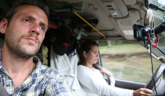
We went through Neiva quickly in the morning, anxious to get to Tierradentro, a remote place in the mountains, before night. We stopped briefly in Campoalegre to celebrate the fact that the truck had 100,000 miles on the counter, and marked this anniversary greasing the tired chassis. I wanted to do an oil change as well, but the desired oil was not available, as the local temperatures were higher than the ones we will encounter in Peru and Bolivia.
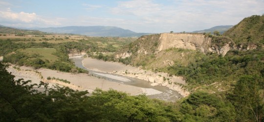 It is also important to stop and speak to people to try to get the latest information on the road condition as well as possible guerilla activities. For the latest, the situation has improved considerably, and it looks like everything is quiet north of Popayan. After this city, sticking to the Pan American should be enough of a precaution, in addition of not driving at night.
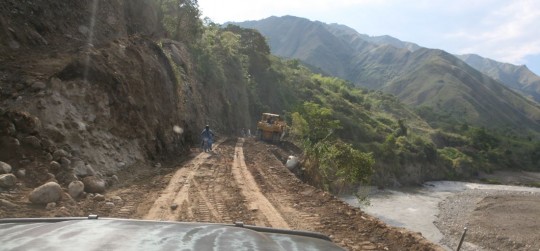
The road to Tierradentro is not the best, and at time, can be cut in several locations. Luckily, the road, even if pretty rough, was drivable. Most tourists prefer San Augustin to our destination, and because Tierradentro is more remote, it guaranties the fact that the mountain sanctuary will not be flooded with people.
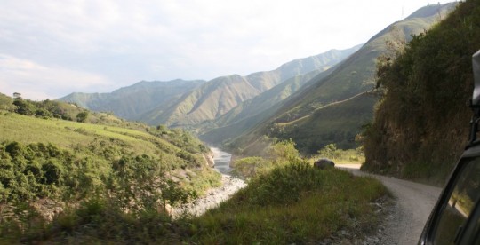
The road, through canyons and hills was fantastic, and the three-hours drive going as high as 2,500 meters (8,000 feet) was exciting. As usual, mountains are the best landscapes we cross, and it is even nicer when you know not everyone can access its marvel.
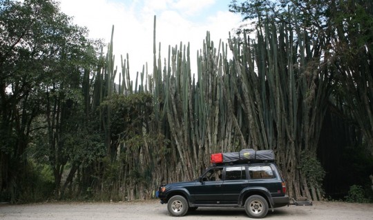
Tierradentro is home to a civilization that disappeared around the 9th century AD. Remains include underground tombs, as well as statues, as in San Augustin. The region has seen a strong guerrillas activity over the years, and only in the past four years it is possible to explore these tombs without being afraid of having to dig your own.
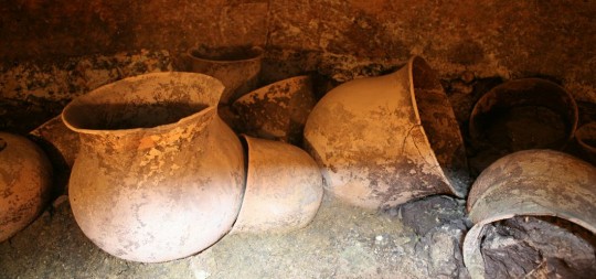
To access the sites, we had to buy tickets at the museum (US$7), and first walk for 25 minutes up the hills. There lays a first group of tombs. We went down in the cramped caves, as deep as 9-meters (30 feet) and saw admired the painted walls and ceilings.
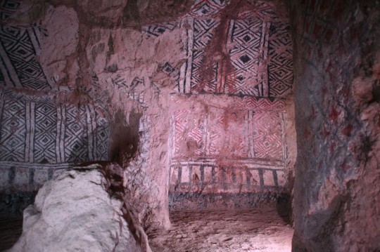
More funeral temples awaited us 20-minutes higher, carved as well in the soft volcanic rock. After another 20 minutes walk, as our reserve in water was disappearing, we reached El Tablon, where statues – 500 years younger than the tombs – where exhibited. From there we went back down to our campsite, in the back of the Hotel El Refugio (recommended, camping US$8 for two people and a car).

After drinking all the water we could put our hands on, and cooking lunch, we went back on the road to try to reach Popayan before dark.
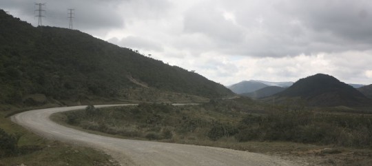
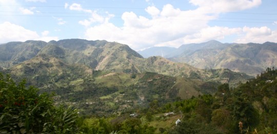 The road was spectacular as well, and did bring us 3,500 meters high (11,500 ft) in a different landscape, typical of higher altitudes. There was a lot of roadwork going on, to reinforce the weak dirt road structure and add pavement.
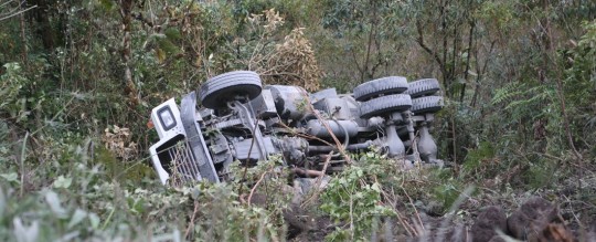
At one place, and few minutes before we passed, a loaded truck felt down 50 meters, taking half of the road along.
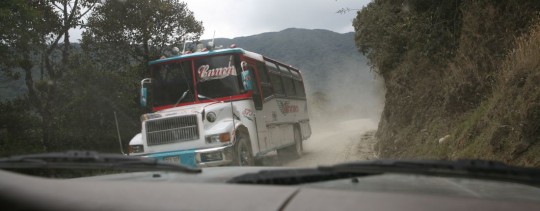
The path itself could be pretty skinny in some part, making passing or crossing other vehicle perilous.
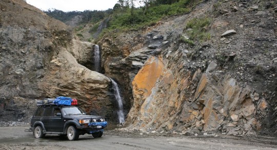
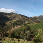
I would have love to spend a night somewhere in this dry landscape, but even if you know the area is now completely secure, you always feel a bit better in unknown territory if you speak to someone first, to make sure camping is not a problem.
Eventually, we reached Popayan in one piece around 4:30 p.m., and began to look for a site we could sleep at.
This is the most I have lived precariously through another person. I feel I’m on this trip with you!!!! Following every step….
Nick! This so amazing! been following you since the start. I check everyday for updates! So jealous of all the places your going to be at. Keep trucking and posting. I could read about your adventures all day, so sad when the post ends. Pictures are great! Wish you the best of luck and high adventure.
Great photos indeed! Thanks for sharing what you are seeing, hearing and experiencing. Drive carefully and stay focused:). Now we’re talking Peru…how great!!!
Looks like things are still going well. I am loving all the pictures of the landscape. Just shows how beautiful the world really is and I am glad I get to see it second hand through your journey. Stay safe and keep rolling!
Awesome!
Hope the solitude of the driving and the scenery are doing both of you well. Sorry that you run across those accidents, bet it wakes you up a bit to some of the dangers! Whew on those narrow roads!! I want to know if you guys took a shower under the water falls!! My guess is yes. I sure would have. (maybe that’s why Nadia’s hair looked wet in the picture driving).
The pictures of the walls and pottery were great, wasn’t that a little wierd being in the old tombs?
I agree with Paschall, we are right there with you both.
Now get movin——-
Marti
The dirt roads, and landscapes bring me back nice memories. The region is very similar to the highlands in Guatemala. Thank you for the nice pictures Nick.
The more I read about your adventures, the more I want to backpack across the world. Our civilization at the AP is disappearing without you here, Nic!
Fantastic. Thanks for the frequent updates and the many pictures, allowing me to vicariously experience this adventure along with you!
Nadia is hard core! Love her behind the wheel – stay safe, amigos.
I like how you started off the Blog with Nadia Adventure Girl in the driving seat. Give her the rains for sure. Great tour you brought us through. Hope They can get that truck out the ditch or hill side. It looks not hopefull, well you both have a blessed time.
Happy to see Nadia is still along!! Great photos! What a great and very beautiful adventure! Hope you’re keeping notes to write a book in detail along with all the photos!! I’m in! Happy trails, be safe.
Beautiful photos and fun to read. So happy no one had to dig their own tomb!! 🙂
Tomorrow when we make our morning coffee I’ll have a visual of where it might of come from. Stay safe and happy travels.
Still following you, NIck! Enjoying all your pictures.
Spectacular! We’re going to run out of English superlatives soon and will have to find an English-French dictionary! Blessings for a continued safe journey.
Have enjoyed reading and look forward each day to getting a new RSS feed on your progress.
Seems a shame the Darien is still in place – like the Bering Strait Bridge / Tunnel / Connection, in it’s case, the lack of 4 billion dollars isolates people, politics, and industry.
In this situation, a great deal of political isolation could be removed at one fell swoop with a two lane paved roadway to South America. To be honest, I had thought, in my readings of various magazines, that his had been done. What a surprise to read your description!!
Everyone in the Western Hemisphere would benefit from connecting these roads.
Everyone.